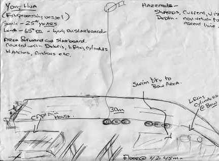

| Vessel Name: | Yong Hua |
| Vessel Nationality: | Thai |
| Type of Vessel: | Fish Processing |
| Depth to Wreck in Meters: | 30 |
| Depth to Seabed in Meters: | 42-45 |
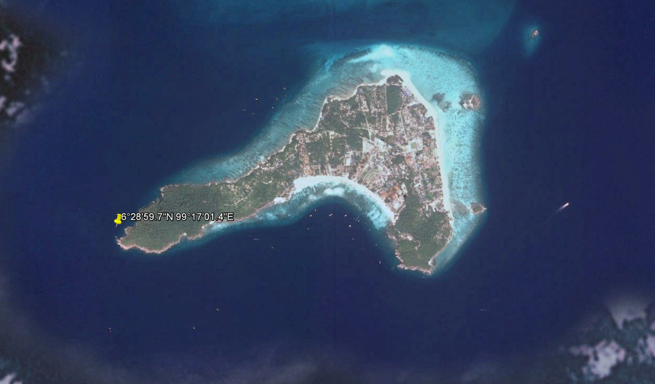
| Location eg Gulf of Siam: | Koh Lipe |
| WGS Co-ordinates North: | 06deg 28min 59.7sec |
| WGS Co-ordinates East: | 99deg 17min 1.4sec |
| Length (m): | 65 |
| Width (m): | 15 |
| Tonnage: | 500 estimated |
| Number of Props: | 2 |
| How the Vessel Sunk?: | Sank around 1990 after an on-board fire. salvage was attempted, wreck was patialy floated into shallower water but aborted after a fatal accident. floatation tanks remain on the seabed. |
| Vessel Activity Priot to Sinking: | Fish Processing |
| Other Information: | It rests, intact on its starboard side on a sandy bottom in 42-45m of water. Descent is made by shot line and touch down on the wreck is about 28-30m. Wreck is settling into the seabed. |
| Bottom Topology: | Sand |
| Dive Team Names and e-mail Addresses: | Kevin Black – [email protected] Mat Payne – [email protected] |
| Your Email: | [email protected] |
| Dive Shop Email: | [email protected] |
| Your Web Site URL: | http://pattayatechnicalandcavedivers.com/ |
